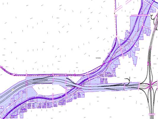
Land Use Data and Analysis:
Adjacent Parcels
•
Highlighted Adjacent Parcels
•
Parcels Labeled with Permanent
Parcel Number
•
Use PPN# to look up additional data
on excel file
Data Source: City of Cleveland
Vintage: 2000
Legend: Labeled parcels along corridor, Transportation links, Labeled roads
How can this map be used:
Assemble land for housing and economic revitalization plan
Observations:
Grouping related to each other like clusters and are these clusters related to transportation or industry proximity?